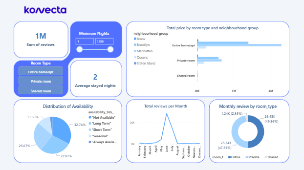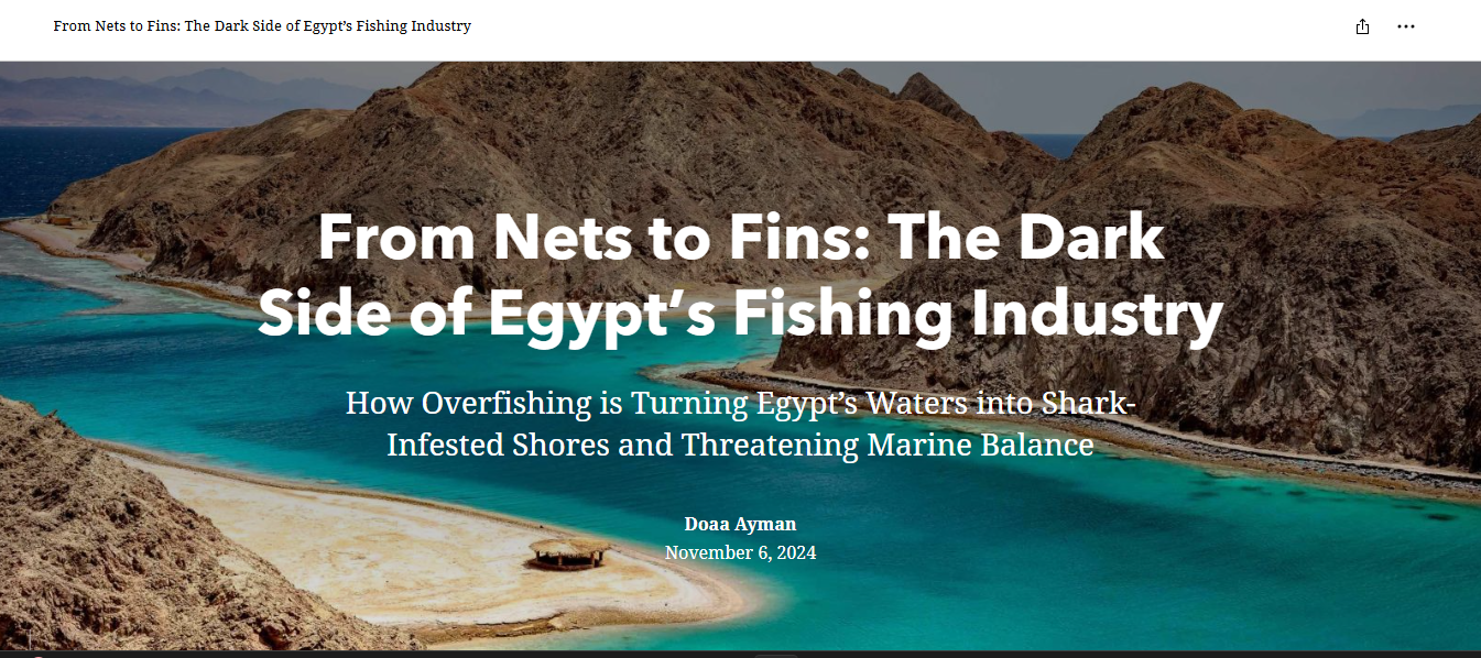
End-to-End Story Map Project
Applied geographic information systems (GIS) to analyze and tackle overfishing challenges in Egypt.
Data Collection & Analysis:
Strengthened my ability to collect, clean, and interpret spatial and environmental data.
Map Creation & Storytelling:
Designed interactive StoryMaps and delivered impactful presentations to communicate findings effectively.
GIS
Data Analysis
StoryMaps